
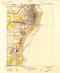
1939 Map of Port Huron
USGS Topo · Published 1939About this map
The confluence of the Black River and the St Clair River defines this 1930s landscape at the international border. The industrial and transit identity of Port Huron is evident in the dense network of rail lines, including the Grand Trunk Western and the Port Huron and Detroit, which facilitated cross-border trade through the rail tunnel near Sarnia. South of the city center, Marysville appears as a burgeoning industrial corridor along the riverfront, while rural schoolhouses like Allendale Sch and Mellore Sch mark the residential fringes. The map illustrates the strategic importance of the waterway, showing Stag Island and the transition from the city grid to the outlying townships. Detailed road labeling, from Gratiot Ave to Beach Rd, provides a clear view of the region's pre-war infrastructure and its connection to neighboring Ontario communities like Point Edward.
Find a feature on this map
41 named features on this map. Tap any name to fly to it.
Don’t see what you’re looking for? This feature index may not catch every label — zoom into the map to look around manually.
Map Details
Editions of this 1939 Port Huron Map
This is the sole edition of this map. No revisions or reprints were ever made.
Other maps of this area

1912 · Port Huron
USGS Topo · 1:62,500

1928 · Hicky
USGS Topo · 1:62,500

1929 · Port Huron
USGS Topo · 1:62,500

1936 · St. Clair
USGS Topo · 1:31,680

1936 · Rattle Run
USGS Topo · 1:31,680

1939 · St. Clair
USGS Topo · 1:24,000

1939 · Smiths Creek
USGS Topo · 1:24,000

1942 · Rattle Run
USGS Topo · 1:24,000
1949 · Port Huron
USGS Topo · 1:24,000
1952 · St. Clair
USGS Topo · 1:24,000