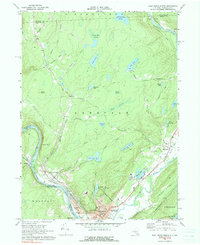
1969 Map of Port Jervis North
USGS Topo · Published 1990About this map
The confluence of the Delaware River and the Neversink River anchors this regional study, where the borders of New York, Pennsylvania, and New Jersey meet near Port Jervis. In the late 1960s, the area's industrial and transport identity was still defined by the Erie Lackawanna Railroad and the historic path of the Old Plank Road. North of the dense city grid of Germantown and Matamoras, the landscape shifts into a series of managed reservoirs and rugged ridges, notably Hawks Nest overlooking the river bend. The map documents numerous civic and religious institutions, such as the Agudath Achim Cem and several local schools like the Sullivan Ave Sch, providing a clear view of the community's footprint before late 20th-century suburban expansion changed the character of outlying hamlets like Sparrow Bush and Huguenot.
Find a feature on this map
67 named features on this map. Tap any name to fly to it.
Don’t see what you’re looking for? This feature index may not catch every label — zoom into the map to look around manually.
Map Details
Editions of this 1969 Port Jervis North Map
Other maps of this area

1906 · Port Jervis
USGS Topo · 1:62,500

1908 · Port Jervis
USGS Topo · 1:62,500

1909 · Monticello
USGS Topo · 1:62,500

1911 · Monticello
USGS Topo · 1:62,500

1913 · Milford
USGS Topo · 1:62,500

1915 · Milford
USGS Topo · 1:62,500

1922 · White Lake
USGS Topo · 1:62,500

1942 · White Lake
USGS Topo · 1:62,500

1942 · Port Jervis North
USGS Topo · 1:24,000
1942 · Otisville
USGS Topo · 1:24,000