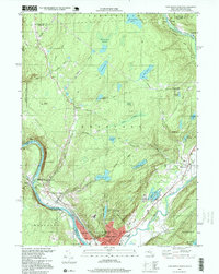
1997 Map of Port Jervis North
USGS Topo · Published 1999About this map
Port Jervis serves as the focal point of this late-20th-century survey, situated at the dramatic confluence where the Delaware River meets the Neversink River. The layout of the city reveals a dense grid of streets such as Kingston Ave and Academy Avenue, supported by civic infrastructure like the West End Sch and Sullivan Ave Sch. The surrounding landscape of Deerpark is defined by a sophisticated system of reservoirs, including Reservoir No. 1 and Reservoir No. 3, which dominate the central highlands.
Find a feature on this map
59 named features on this map. Tap any name to fly to it.
Don’t see what you’re looking for? This feature index may not catch every label — zoom into the map to look around manually.
Map Details
Editions of this 1997 Port Jervis North Map
This is the sole edition of this map. No revisions or reprints were ever made.
Other maps of this area

1906 · Port Jervis
USGS Topo · 1:62,500

1908 · Port Jervis
USGS Topo · 1:62,500

1909 · Monticello
USGS Topo · 1:62,500

1911 · Monticello
USGS Topo · 1:62,500

1913 · Milford
USGS Topo · 1:62,500

1915 · Milford
USGS Topo · 1:62,500

1922 · White Lake
USGS Topo · 1:62,500

1942 · White Lake
USGS Topo · 1:62,500

1942 · Port Jervis North
USGS Topo · 1:24,000
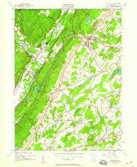
1942 · Otisville
USGS Topo · 1:24,000