
1988 Map of Port Moller
USGS Topo · Published 1991About this map
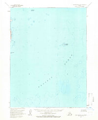
The Alaska Peninsula coastline and the jagged reaches of the Shumagin Islands are captured here in a transition period of the late 1980s. Maritime and industrial activity is centered on points of land like Sand Point and Squaw Harbor on Unga Island, while the northern coast shows the remote Nelson Lagoon Village near the Bering Sea. The map reveals a landscape defined by volcanic peaks such as Pavlof Volcano, Little Pavlof, and Mount Hague, which loom over the expansive Alaska Peninsula National Wildlife Refuge. Detailed bathymetry illustrates the deep inlets of Port Moller and Herendeen Bay, where the geography supported small-scale operations noted by labels like Cannery, Miner, and the legacy of resource extraction at Coal Bluff. This survey emphasizes the intersection of protected wilderness and the isolated fishing and mining outposts of the Aleutians East Borough.
Find a feature on this map
86 named features on this map. Tap any name to fly to it.
Don’t see what you’re looking for? This feature index may not catch every label — zoom into the map to look around manually.
Map Details
Editions of this 1988 Port Moller Map
This is the sole edition of this map. No revisions or reprints were ever made.
Other maps of this area

1943 · Fort Randall
USGS Topo · 1:250,000

1949 · False Pass
USGS Topo · 1:250,000

1949 · Fort Randall
USGS Topo · 1:250,000

1950 · False Pass
USGS Topo · 1:250,000

1950 · Fort Randall
USGS Topo · 1:250,000

1951 · Stepovak Bay
USGS Topo · 1:250,000

1953 · Port Moller
USGS Topo · 1:250,000

1963 · Port Moller D-5
USGS Topo · 1:63,360

1963 · Port Moller A-5
USGS Topo · 1:63,360
1963 · Port Moller A-4
USGS Topo · 1:63,360