
1963 Map of Port Moller C-2
USGS Topo · Published 1967About this map
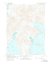
Albatross Anchorage and the complex shoreline of the Alaska Peninsula dominate this early 1960s hydrographic and topographic study. The landscape is defined by its maritime utility, featuring protective points and hazards like Monolith Pt, Renshaw Pt, and the Ballast Reef. Small, isolated Cabins are scattered along the coastlines of Dorenoi Bay and San Diego Bay, suggesting a seasonal or subsistence-based presence in this maritime environment.
Find a feature on this map
24 named features on this map. Tap any name to fly to it.
Don’t see what you’re looking for? This feature index may not catch every label — zoom into the map to look around manually.
Map Details
Editions of this 1963 Port Moller C-2 Map
2 editions found
Other maps of this area

1953 · Port Moller
USGS Topo · 1:250,000

1963 · Port Moller D-3
USGS Topo · 1:63,360

1963 · Port Moller B-2
USGS Topo · 1:63,360

1963 · Port Moller B-1
USGS Topo · 1:63,360

1963 · Port Moller C-1
USGS Topo · 1:63,360

1963 · Port Moller D-2
USGS Topo · 1:63,360
1963 · Port Moller D-1
USGS Topo · 1:63,360

1983 · Port Moller B-3
USGS Topo · 1:63,360

1983 · Port Moller C-3
USGS Topo · 1:63,360

1988 · Port Moller
USGS Topo · 1:250,000