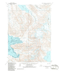
1963 Map of Port Moller D-1
USGS Topo · Published 1986About this map
The Alaska Peninsula National Wildlife Refuge dominates this mid-century survey, capturing a wild stretch of the Alaska Peninsula defined by complex coastal waters and glacial drainage. Large expanses of water like Bear Lake and the silty reaches of the Milky River drain toward the coast, where Port Moller splits into the Left Head and Right Head. Human presence is sparse, marked only by isolated outposts like Norge, Little Norway, and a solitary Cabin near the mudflats. The presence of Frying Pan and Clark Bay on the eastern side of the peninsula illustrates the maritime focus of the era, while the inland reaches remain an intricate network of unnamed peaks and the King Salmon River valley.
Find a feature on this map
14 named features on this map. Tap any name to fly to it.
Don’t see what you’re looking for? This feature index may not catch every label — zoom into the map to look around manually.
Map Details
Editions of this 1963 Port Moller D-1 Map
2 editions found
Other maps of this area

1951 · Stepovak Bay
USGS Topo · 1:250,000

1953 · Port Moller
USGS Topo · 1:250,000

1963 · Port Moller C-2
USGS Topo · 1:63,360

1963 · Chignik A-6
USGS Topo · 1:63,360

1963 · Port Moller C-1
USGS Topo · 1:63,360

1963 · Chignik A-7
USGS Topo · 1:63,360

1963 · Stepovak Bay D-6
USGS Topo · 1:63,360

1963 · Port Moller D-2
USGS Topo · 1:63,360

1963 · Chignik
USGS Topo · 1:250,000
1963 · Chignik A-8
USGS Topo · 1:63,360