1963 Map of Stepovak Bay D-6
USGS Topo · Published 1967About this map
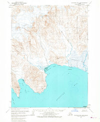
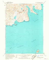
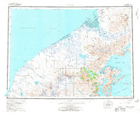
Big River meanders through the northeast of this Alaskan coastal quadrangle, eventually spilling into the marshy expanse of Stepanof Flats. The landscape is dominated by the dramatic coastline of the Kupreanof Peninsula, where the high ground of Lookout Hill and Red Hill overlooks the cold waters of Stepovak Bay and Ramsey Bay. Numerous topographic markers and benchmarks, such as Dent, Bales, and Cent, reflect the meticulous surveying efforts of the early 1960s. The shoreline is highly detailed, showing Tidal Flat zones and prominent maritime hazards like Gull Rocks and Wall Rock. The western edge of the map features the steep terrain surrounding Grub Gulch and Clark Bay, highlighting a wilderness area shaped by glacial activity, evidenced by the Crevasses noted in the high northern peaks.
Find a feature on this map
25 named features on this map. Tap any name to fly to it.
Don’t see what you’re looking for? This feature index may not catch every label — zoom into the map to look around manually.
Map Details
Editions of this 1963 Stepovak Bay D-6 Map
3 editions found
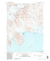

Other maps of this area

1951 · Stepovak Bay
USGS Topo · 1:250,000

1953 · Port Moller
USGS Topo · 1:250,000
1963 · Stepovak Bay C-5 and C-6
USGS Topo · 1:63,360
1963 · Chignik A-6
USGS Topo · 1:63,360
1963 · Port Moller C-1
USGS Topo · 1:63,360
1963 · Chignik A-5
USGS Topo · 1:63,360
1963 · Chignik A-7
USGS Topo · 1:63,360
1963 · Stepovak Bay D-5
USGS Topo · 1:63,360
1963 · Chignik
USGS Topo · 1:250,000
1963 · Stepovak Bay
USGS Topo · 1:250,000