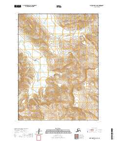
2020 Map of Port Moller D-1 NE
USGS Topo · Published 2020About this map
Milky River flows through this remote section of the Alaska Peninsula, a landscape defined by glacial runoff and shifting braided channels. This 2020 survey documents a vast uninhabited region within the Aleutians East Borough, where the terrain is marked by extreme elevation changes and drainage patterns that feed into the larger river system. The map serves as a contemporary record of the public land survey system, illustrating the boundaries of t48s r70w, t49s r70w, and t50s r70w as they intersect with the natural topography. Without roads or permanent settlements, the area remains a study in high-latitude hydrology and wild coastline interior, where the glacial character of the water is literally etched into the landscape's nomenclature.
Find a feature on this map
7 named features on this map. Tap any name to fly to it.
Don’t see what you’re looking for? This feature index may not catch every label — zoom into the map to look around manually.
Map Details
Editions of this 2020 Port Moller D-1 NE Map
This is the sole edition of this map. No revisions or reprints were ever made.
Other maps of this area

1951 · Stepovak Bay
USGS Topo · 1:250,000

1953 · Port Moller
USGS Topo · 1:250,000

1963 · Chignik A-6
USGS Topo · 1:63,360

1963 · Chignik A-7
USGS Topo · 1:63,360

1963 · Stepovak Bay D-6
USGS Topo · 1:63,360

1963 · Chignik
USGS Topo · 1:250,000

1963 · Stepovak Bay
USGS Topo · 1:250,000
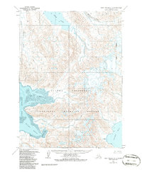
1963 · Port Moller D-1
USGS Topo · 1:63,360

1969 · Stepovak Bay
USGS Topo · 1:250,000

1988 · Port Moller
USGS Topo · 1:250,000