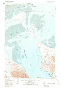
1963 Map of Port Moller D-3
USGS Topo · Published 1976About this map
Herendeen Bay and the interconnected waters of the Alaska Peninsula dominate this 1963 survey, revealing a landscape defined by tidal activity and coastal resource extraction. The presence of Mine Harbor and Coal Point near the Coal Valley suggests a history of mineral exploration or transport along these cold shores. To the north, the massive Cape Rozhnof projects into Mud Bay, separated from the open sea by the barrier-like Kudobin Islands and the shallow Nelson Lagoon. Remote outposts are visible at the Village Spit Landing Strip and a solitary Cabin located near Black Point. The intricate navigation of the Hague Channel and Johnston Channel provides insight into the maritime paths used by fishermen and explorers navigating between the peninsula's jagged points like Bold Bluff Point and Shingle Point.
Find a feature on this map
46 named features on this map. Tap any name to fly to it.
Don’t see what you’re looking for? This feature index may not catch every label — zoom into the map to look around manually.
Map Details
Editions of this 1963 Port Moller D-3 Map
2 editions found
Other maps of this area

1953 · Port Moller
USGS Topo · 1:250,000

1963 · Port Moller D-3
USGS Topo · 1:63,360

1963 · Port Moller C-2
USGS Topo · 1:63,360
1963 · Port Moller D-4
USGS Topo · 1:63,360

1963 · Port Moller D-2
USGS Topo · 1:63,360
1963 · Chignik A-8
USGS Topo · 1:63,360

1983 · Port Moller C-4
USGS Topo · 1:63,360

1983 · Port Moller C-3
USGS Topo · 1:63,360

1988 · Port Moller
USGS Topo · 1:250,000
2020 · Port Moller D-3 NW
USGS Topo · 1:25,000