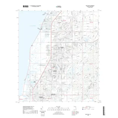
2018 Map of Port Richey
USGS Topo · Published 2018About this map
Bayonet Point and Jasmine Estates anchor this coastal stretch of Pasco County, illustrating a densely developed residential landscape at the edge of the Gulf of Mexico. The map details a complex interface between suburban expansion and the Florida wetlands, where neighborhoods are punctuated by numerous bodies of water like Smokehouse Pond and Orchid Lake. To the south, the winding course of the Pithlachascotee River flows toward New Port Richey, marking the natural drainage of the region before it meets the salt marshes and bayous of the coast.
Find a feature on this map
52 named features on this map. Tap any name to fly to it.
Don’t see what you’re looking for? This feature index may not catch every label — zoom into the map to look around manually.
Map Details
Editions of this 2018 Port Richey Map
This is the sole edition of this map. No revisions or reprints were ever made.
Other maps of this area

1943 · Tarpon Springs
USGS Topo · 1:31,680

1943 · Odessa
USGS Topo · 1:24,000

1943 · Elfers
USGS Topo · 1:24,000

1944 · Elfers
USGS Topo · 1:31,680

1944 · Odessa
USGS Topo · 1:31,680

1948 · Elfers
USGS Topo · 1:25,000

1949 · Odessa
USGS Topo · 1:25,000

1954 · Port Richey
USGS Topo · 1:24,000

1954 · Fivay
USGS Topo · 1:24,000

1954 · Aripeka
USGS Topo · 1:24,000