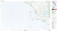
1978 Map of Port Saint Joe
USGS Topo · Published 1980About this map
Port St Joe and the surrounding coastline of Gulf and Franklin counties appear here as they were updated in the late 1970s. The geography is defined by the long, slender St Joseph Spit shielding the waters of St Joseph Bay and the significant barrier islands of the St Vincent National Wildlife Refuge. This map illustrates the vital intersection of water and transport, where the Intracoastal Waterway cuts through toward Lake Wimico, and the Apalachicola Northern railroad line services the coastal settlements. Extensive wetlands and river systems like the Apalachicola River and Brothers River dominate the eastern portion, contrasting with the military footprint of Tyndall Air Force Base to the northwest. Smaller locales such as White City and Overstreet are shown alongside notable maritime landmarks like the Cape St George Lighthouse.
Find a feature on this map
64 named features on this map. Tap any name to fly to it.
Don’t see what you’re looking for? This feature index may not catch every label — zoom into the map to look around manually.
Map Details
Editions of this 1978 Port Saint Joe Map
2 editions found
Other maps of this area

1943 · St Joseph Spit
USGS Topo · 1:31,680

1943 · Beacon Beach
USGS Topo · 1:31,680

1943 · Port St. Joe
USGS Topo · 1:31,680

1943 · Cape San Blas
USGS Topo · 1:31,680

1943 · West Pass
USGS Topo · 1:31,680

1943 · Overstreet
USGS Topo · 1:31,680

1943 · Apalachicola
USGS Topo · 1:31,680

1943 · Crooked Island
USGS Topo · 1:31,680

1943 · Indian Pass
USGS Topo · 1:24,000

1943 · Jackson River
USGS Topo · 1:24,000