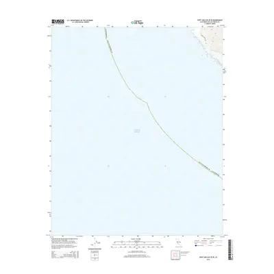
2015 Map of Port San Luis OE W
USGS Topo · Published 2015About this map
The coastal waters of the Pacific Ocean dominate this 2015 survey, which covers the shoreline of San Luis Obispo County along the central California coast. The map focuses heavily on the offshore area, providing clear delineation of the coastal boundary where land meets sea. On the small portion of land visible in the northeastern corner, the route of Pecho Valley Rd is traced through the hills, providing a glimpse of the coastal infrastructure that skirts the rugged topography above the shoreline. This map is primarily a study of the maritime geography and the immediate coastal transition, rather than a dense settlement record.
Find a feature on this map
4 named features on this map. Tap any name to fly to it.
Don’t see what you’re looking for? This feature index may not catch every label — zoom into the map to look around manually.
Map Details
Editions of this 2015 Port San Luis OE W Map
This is the sole edition of this map. No revisions or reprints were ever made.
Other maps of this area

1897 · Port Harford
USGS Topo · 1:62,500

1897 · Cayucos
USGS Topo · 1:62,500

1900 · San Luis
USGS Topo · 1:125,000

1937 · Cayucos
USGS Topo · 1:62,500

1941 · Port San Luis
USGS Topo · 1:62,500

1943 · Cayucos
USGS Topo · 1:62,500
1945 · Port San Luis
USGS Topo · 1:62,500

1947 · San Luis Obispo
USGS Topo · 1:250,000

1948 · San Luis Obispo
USGS Topo · 1:250,000
1951 · Port San Luis
USGS Topo · 1:62,500