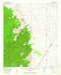
1958 Map of Portal
USGS Topo · Published 1963About this map
The Coronado National Forest dominates this mid-century portrait of the Chiricahua Mountains, where the high desert meets steep canyon walls along the Arizona-New Mexico border. Centered on the gateway community of Portal, the landscape is defined by the dramatic descent of Cave Creek Canyon toward the Animas Valley. The map detail reveals a specialized mountain economy of the late 1950s, highlighting the Southwestern Research Station and the Portal Ranger Sta.
Find a feature on this map
51 named features on this map. Tap any name to fly to it.
Don’t see what you’re looking for? This feature index may not catch every label — zoom into the map to look around manually.
Map Details
Editions of this 1958 Portal Map
4 editions found
Other maps of this area

1917 · San Simon
USGS Topo · 1:125,000

1917 · Chiricahua
USGS Topo · 1:125,000

1918 · Animas Peak
USGS Topo · 1:62,500

1918 · Pratt
USGS Topo · 1:62,500

1919 · Pratt
USGS Topo · 1:62,500

1919 · Chiricahua
USGS Topo · 1:125,000

1920 · Animas Peak
USGS Topo · 1:62,500

1926 · Cochise Head
USGS Topo · 1:62,500

1926 · Rodeo
USGS Topo · 1:62,500

1926 · Rucker
USGS Topo · 1:62,500