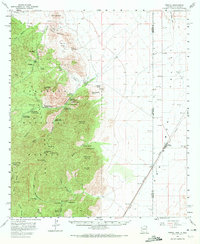
1958 Map of Portal
USGS Topo · Published 1972About this map
The eastern slopes of the Chiricahua Mountains meet the San Simon Valley in this late 1950s survey of the Arizona-New Mexico border. Centered on the Coronado National Forest, the map captures a transition from the rugged canyons of the high peaks to the desert floor. Small settlements and specialized outposts like Galeyville, Paradise, and the Southwestern Research Station dot the foothills near the mouth of Cave Creek Canyon. Local history is anchored by family-named landmarks like the Roush Ranch and the Paradise Cemetery.
Find a feature on this map
63 named features on this map. Tap any name to fly to it.
Don’t see what you’re looking for? This feature index may not catch every label — zoom into the map to look around manually.
Map Details
Editions of this 1958 Portal Map
4 editions found
Other maps of this area

1917 · San Simon
USGS Topo · 1:125,000

1917 · Chiricahua
USGS Topo · 1:125,000

1918 · Animas Peak
USGS Topo · 1:62,500

1918 · Pratt
USGS Topo · 1:62,500

1919 · Pratt
USGS Topo · 1:62,500

1919 · Chiricahua
USGS Topo · 1:125,000

1920 · Animas Peak
USGS Topo · 1:62,500

1926 · Cochise Head
USGS Topo · 1:62,500

1926 · Rodeo
USGS Topo · 1:62,500

1926 · Rucker
USGS Topo · 1:62,500