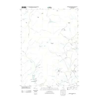
2013 Map of Porter Corners
USGS Topo · Published 2013About this map
Porter Corners serves as the primary settlement in this part of Saratoga County, where the southern foothills of the Adirondacks meet the Kayaderosseras Range. The landscape is defined by a dense network of water bodies and marshlands, including Lake Desolation, Mulleyville Pond, and the expansive Archer Vly. These wetlands feed various branches of Kayaderosseras Cr and Black Cr, illustrating the complex drainage patterns of the plateau. High points like Spruce Mountain and Pompy Ridge provide significant relief against the valleys. For those researching local lineages, the map identifies several burial sites scattered across the rural townships, such as Earls Cem, Day Cem, and Ballou Cem. The area maintains its character as a transition between established small communities and the more isolated, high-elevation terrain to the north and west.
Find a feature on this map
79 named features on this map. Tap any name to fly to it.
Don’t see what you’re looking for? This feature index may not catch every label — zoom into the map to look around manually.
Map Details
Editions of this 2013 Porter Corners Map
This is the sole edition of this map. No revisions or reprints were ever made.
Other maps of this area

1899 · Broadalbin
USGS Topo · 1:62,500

1902 · Broadalbin
USGS Topo · 1:62,500

1902 · Saratoga
USGS Topo · 1:62,500

1903 · Luzerne
USGS Topo · 1:62,500

1910 · Stony Creek
USGS Topo · 1:62,500

1934 · Saratoga Springs
USGS Topo · 1:24,000

1935 · Middle Grove
USGS Topo · 1:24,000

1935 · Corinth
USGS Topo · 1:24,000

1942 · Saratoga
USGS Topo · 1:62,500

1945 · Edinburg
USGS Topo · 1:24,000