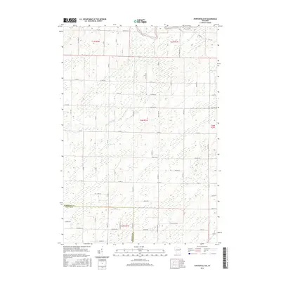
2016 Map of Porterfield SW
USGS Topo · Published 2016About this map
The Peshtigo River winds through the northern reaches of this Wisconsin landscape, where the boundary between Marinette County and Oconto County dictates the survey and road patterns of the early twenty-first century. This territory is defined by its transition from the northern forests into a grid of rural lanes and family-named roads. The Little Peshtigo River cuts across the central sections, creating a natural drainage system that influenced the placement of routes like Tower Hill Rd and Red School Rd. The map reveals a high concentration of wetlands and small water bodies characteristic of the Upper Midwest's glacial geography, showing how modern property lines and local infrastructure such as Little River Rd and Co Rd Q respect these ancient environmental features.
Find a feature on this map
66 named features on this map. Tap any name to fly to it.
Don’t see what you’re looking for? This feature index may not catch every label — zoom into the map to look around manually.
Map Details
Editions of this 2016 Porterfield SW Map
This is the sole edition of this map. No revisions or reprints were ever made.
Other maps of this area

1939 · Porterfield
USGS Topo · 1:48,000

1941 · Coleman
USGS Topo · 1:48,000

1942 · Coleman
USGS Topo · 1:48,000

1942 · Porterfield
USGS Topo · 1:48,000

1950 · Coleman
USGS Topo · 1:48,000

1954 · Iron Mountain
USGS Topo · 1:250,000

1954 · Escanaba
USGS Topo · 1:250,000

1954 · Manitowoc
USGS Topo · 1:250,000

1955 · Green Bay
USGS Topo · 1:250,000

1956 · Oconto
USGS Topo · 1:62,500