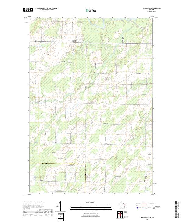
2022 Map of Porterfield SW
USGS Topo · Published 2022About this map
Saint Matthew's Evangelical Lutheran Cem stands as a focal point for local history in this rural landscape where the Marinette and Oconto county lines meet. The terrain is defined by the winding course of the Little Peshtigo River, which meanders through the central and eastern sections of the quadrangle. The road network reflects a deeply rooted agricultural and timber-land heritage, with numerous family and descriptive names like Leslie Rd, Augustine Rd, and Red School Rd partitioning the countryside. A localized civic presence is noted at the Town Hall, while proximity to the river is highlighted by access points like Little River Park Ln. The map reveals a pattern of section-line roads and scattered clearings typical of the northern Wisconsin lake-and-river country.
Find a feature on this map
69 named features on this map. Tap any name to fly to it.
Don’t see what you’re looking for? This feature index may not catch every label — zoom into the map to look around manually.
Map Details
Editions of this 2022 Porterfield SW Map
This is the sole edition of this map. No revisions or reprints were ever made.
Other maps of this area

1939 · Porterfield
USGS Topo · 1:48,000

1941 · Coleman
USGS Topo · 1:48,000

1942 · Coleman
USGS Topo · 1:48,000

1942 · Porterfield
USGS Topo · 1:48,000

1950 · Coleman
USGS Topo · 1:48,000

1954 · Iron Mountain
USGS Topo · 1:250,000

1954 · Escanaba
USGS Topo · 1:250,000

1954 · Manitowoc
USGS Topo · 1:250,000

1955 · Green Bay
USGS Topo · 1:250,000

1956 · Oconto
USGS Topo · 1:62,500