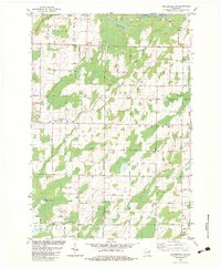
1982 Map of Porterfield SW
USGS Topo · Published 1983About this map
The Marinette and Oconto County line divides this rural landscape in the early 1980s, where the winding course of the Little Peshtigo River and Bundy Creek dictate the layout of farmsteads and roads. The small settlement at Equity Park and the presence of St Matthews Ch serve as local focal points for the community. The land is defined by its agricultural and extractive utility, with numerous Gravel Pits and Sandpits scattered across the townships of Beaver, Pound, and Grover. The road network is heavily gridded but interrupted by the natural drainage of the Little River township to the south. Local family names and civic history are preserved in labels for thoroughfares like Mubach Road, Behnke Road, and Red School Rd, reflecting a period of established rural infrastructure before modern expansion altered these traditional Wisconsin townships.
Find a feature on this map
32 named features on this map. Tap any name to fly to it.
Don’t see what you’re looking for? This feature index may not catch every label — zoom into the map to look around manually.
Map Details
Editions of this 1982 Porterfield SW Map
This is the sole edition of this map. No revisions or reprints were ever made.
Other maps of this area

1939 · Porterfield
USGS Topo · 1:48,000

1941 · Coleman
USGS Topo · 1:48,000

1942 · Coleman
USGS Topo · 1:48,000

1942 · Porterfield
USGS Topo · 1:48,000

1950 · Coleman
USGS Topo · 1:48,000

1954 · Iron Mountain
USGS Topo · 1:250,000

1954 · Escanaba
USGS Topo · 1:250,000

1954 · Manitowoc
USGS Topo · 1:250,000

1955 · Green Bay
USGS Topo · 1:250,000

1956 · Oconto
USGS Topo · 1:62,500