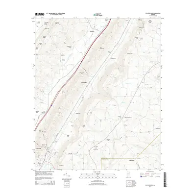
2014 Map of Portersville
USGS Topo · Published 2014About this map
Collinsville anchors the southwestern valley floor of this Northeast Alabama terrain, where the ridge-and-valley geography dictates the movement of people and water. The map traces the corridor of Big Wills Creek as it flows through Big Wills Valley, flanked by the significant heights of Sand Mountain to the west and Lookout Mountain to the east. This topographical arrangement creates a series of isolated coves and strategic gaps, such as Portersville Gap and Halls Gap, which have historically funneled travel and settlement patterns.
Find a feature on this map
153 named features on this map. Tap any name to fly to it.
Don’t see what you’re looking for? This feature index may not catch every label — zoom into the map to look around manually.
Map Details
Editions of this 2014 Portersville Map
This is the sole edition of this map. No revisions or reprints were ever made.
Other maps of this area

1893 · Fort Payne
USGS Topo · 1:125,000

1898 · Fort Payne
USGS Topo · 1:125,000

1900 · Fort Payne
USGS Topo · 1:125,000

1936 · Crossville
USGS Topo · 1:24,000

1936 · Roden Gap
USGS Topo · 1:24,000

1936 · Chavies
USGS Topo · 1:24,000
1936 · Fyffe
USGS Topo · 1:24,000

1946 · Portersville
USGS Topo · 1:24,000

1946 · Ft Payne
USGS Topo · 1:24,000
1946 · Chavies
USGS Topo · 1:24,000