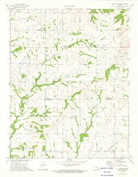
1973 Map of Porterville
USGS Topo · Published 1975About this map
Porterville sits near the crossing of several county lines in this southeastern Kansas landscape, where the Old Indian Treaty Boundary still marks the land division between Bourbon Co and Allen and Neosho Counties. The area is defined by its agricultural and early industrial character, with numerous oil wells and a dedicated oil field scattered across the drainage of Flat Rock Creek and Little Walnut Creek. Genealogists will find several community landmarks, including Harmony Cem, Rosedale Cem, and Walnut Cem, which served the rural population before mid-century shifts. The southern edge of the map features the Missouri - Kansas - Texas railroad line passing near the small settlement of Vehlow, illustrating the vital rail links that supported the region's transport and energy economy during the early 1970s.
Find a feature on this map
23 named features on this map. Tap any name to fly to it.
Don’t see what you’re looking for? This feature index may not catch every label — zoom into the map to look around manually.
Map Details
Editions of this 1973 Porterville Map
This is the sole edition of this map. No revisions or reprints were ever made.
Other maps of this area

1884 · Fort Scott
USGS Topo · 1:125,000

1886 · Iola
USGS Topo · 1:125,000

1886 · Fort Scott
USGS Topo · 1:125,000

1893 · Fort Scott
USGS Topo · 1:125,000

1893 · Iola
USGS Topo · 1:125,000

1904 · Iola
USGS Topo · 1:125,000

1947 · Joplin
USGS Topo · 1:250,000

1948 · Erie
USGS Topo · 1:62,500

1948 · Girard
USGS Topo · 1:62,500

1949 · Erie
USGS Topo · 1:62,500