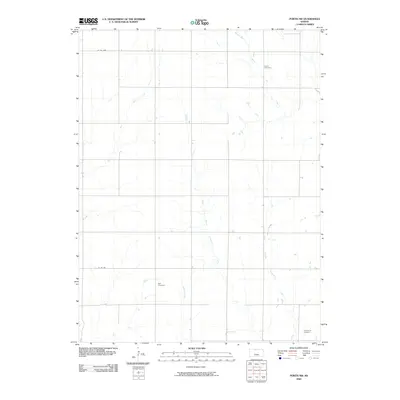
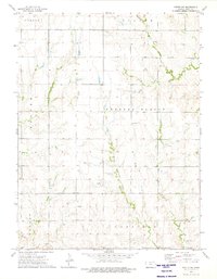
2009 Map of Portis NW
USGS Topo · Published 2009About this map
Custer Cemetery and Bell Cemetery sit among the section-line roads of north-central Kansas, serving as quiet markers of rural heritage in Smith County. This landscape is defined by its drainage patterns, where small waterways like Monkey Run and Dry Creek feed into the larger creek systems. The geography reveals a distinct divide between the West Branch Twelvemile Creek and the East Branch Twelvemile Creek, which converge as they flow southward. Near the southern edge, Twelvemile Cemetery anchors a sparsely populated region where the infrastructure is largely limited to unpaved county roads like Co RD 1060. The map illustrates a contemporary agricultural grid that maintains the same cadastral boundaries established in the nineteenth century, preserving a sense of place for family researchers and local historians.
Find a feature on this map
11 named features on this map. Tap any name to fly to it.
Don’t see what you’re looking for? This feature index may not catch every label — zoom into the map to look around manually.
Map Details
Editions of this 2009 Portis NW Map
This is the sole edition of this map. No revisions or reprints were ever made.
Other maps of this area

1893 · Smith Center
USGS Topo · 1:125,000

1955 · Beloit
USGS Topo · 1:250,000

1959 · Beloit
USGS Topo · 1:250,000

1960 · Downs North
USGS Topo · 1:24,000

1961 · Portis
USGS Topo · 1:24,000

1961 · Harlan
USGS Topo · 1:24,000
1973 · Portis NE
USGS Topo · 1:24,000
1973 · Smith Center
USGS Topo · 1:24,000
1973 · Lebanon
USGS Topo · 1:24,000
1973 · Portis NW
USGS Topo · 1:24,000