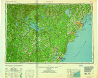
1959 Map of Portland
USGS Topo · Published 1959About this map
Portland and its surrounding coastal and lake districts appear here as they were organized in the mid-century, defined by a complex network of maritime defenses and established rail lines. Coastal security is prominent at the mouth of Casco Bay, where a string of military installations including Fort McKinley, Fort Levett, and Fort Williams guard the approach to the harbor. Further south along the Maine New Hampshire border, the Piscataqua River serves as the gateway to Portsmouth, flanked by Fort Constitution and Fort Dearborn.
Find a feature on this map
179 named features on this map. Tap any name to fly to it.
Don’t see what you’re looking for? This feature index may not catch every label — zoom into the map to look around manually.
Map Details
Editions of this 1959 Portland Map
2 editions found

Other maps of this area

1888 · Newburyport
USGS Topo · 1:62,500

1888 · Haverhill
USGS Topo · 1:62,500

1890 · Haverhill
USGS Topo · 1:62,500

1890 · Newburyport
USGS Topo · 1:62,500

1891 · Portland
USGS Topo · 1:62,500

1891 · Biddeford
USGS Topo · 1:62,500

1891 · Berwick
USGS Topo · 1:62,500

1891 · Kennebunk
USGS Topo · 1:62,500

1891 · Buxton
USGS Topo · 1:62,500

1891 · Newfield
USGS Topo · 1:62,500