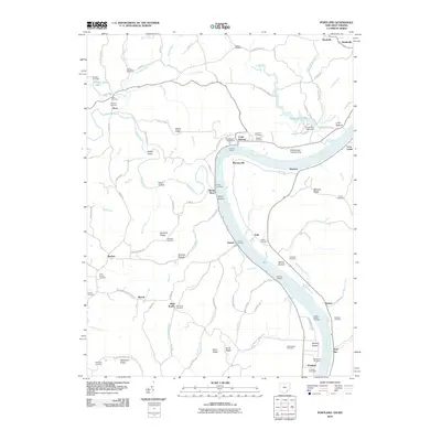
2010 Map of Portland
USGS Topo · Published 2010About this map
The Ohio River carves a sweeping path between Ohio and West Virginia, defining the character of this riverine landscape. Historic river-access points like Hazael Landing, Watsons Landing, and Germans Landing speak to a time when the waterway was the primary artery for local commerce and travel. The terrain is marked by sharp elevation changes, where ridges such as Rainbow Ridge and Milhoan Ridge rise above the bottomlands. Scattered across these hills are numerous family and community burial grounds, including the Middleswart Cemetery and Stewart Cemetery, which offer vital touchstones for genealogical research in Meigs County.
Find a feature on this map
119 named features on this map. Tap any name to fly to it.
Don’t see what you’re looking for? This feature index may not catch every label — zoom into the map to look around manually.
Map Details
Editions of this 2010 Portland Map
This is the sole edition of this map. No revisions or reprints were ever made.
Other maps of this area

1906 · Belleville
USGS Topo · 1:62,500

1907 · Keno
USGS Topo · 1:62,500

1907 · Ripley
USGS Topo · 1:62,500

1908 · Ravenswood
USGS Topo · 1:62,500

1924 · Belleville
USGS Topo · 1:62,500

1926 · Ravenswood
USGS Topo · 1:62,500

1926 · Belleville
USGS Topo · 1:62,500

1926 · Ripley
USGS Topo · 1:62,500

1928 · Ravenswood
USGS Topo · 1:62,500

1928 · Ripley
USGS Topo · 1:62,500