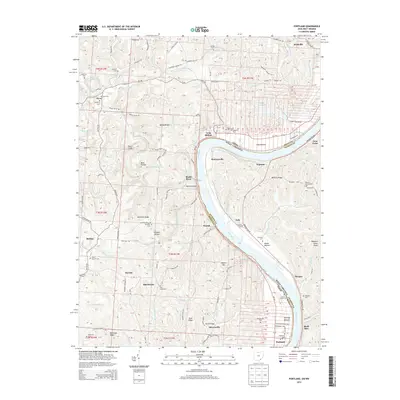
2013 Map of Portland
USGS Topo · Published 2013About this map
The Ohio River forms a sweeping meander that separates Meigs County, Ohio, from Jackson County, West Virginia, anchoring a landscape of tight ridges and bottomlands. Along the northern bank, the settlement of Long Bottom and the village of Portland sit within fertile bends of the river, while the interior is marked by significant topographic features like Bigley Ridge and Milhoan Ridge. This area is dense with family and community landmarks, including numerous small burial grounds such as Cowdery Cem and Middleswart Cem, which reflect the generations of residents who farmed these hills.
Find a feature on this map
108 named features on this map. Tap any name to fly to it.
Don’t see what you’re looking for? This feature index may not catch every label — zoom into the map to look around manually.
Map Details
Editions of this 2013 Portland Map
This is the sole edition of this map. No revisions or reprints were ever made.
Other maps of this area

1906 · Belleville
USGS Topo · 1:62,500

1907 · Keno
USGS Topo · 1:62,500

1907 · Ripley
USGS Topo · 1:62,500

1908 · Ravenswood
USGS Topo · 1:62,500

1924 · Belleville
USGS Topo · 1:62,500

1926 · Ravenswood
USGS Topo · 1:62,500

1926 · Belleville
USGS Topo · 1:62,500

1926 · Ripley
USGS Topo · 1:62,500

1928 · Ravenswood
USGS Topo · 1:62,500

1928 · Ripley
USGS Topo · 1:62,500