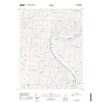
2019 Map of Portland
USGS Topo · Published 2019About this map
The Ohio River carves a sweeping path through this borderland, separating Meigs County, Ohio, from Jackson County, West Virginia. The landscape is defined by a dense network of ridges and hollows, where family history is preserved in numerous upland burial grounds such as Sand Hill Cem and the Middleswart Cemetery. Small river settlements like Long Bottom and Portland anchor the Ohio side, while Murraysville and Neptune sit across the water. The terrain rises sharply from the riverbanks to named heights like Milhoan Ridge and Bigley Ridge, intersected by winding waterways including the Shade River and Forked Run. This survey highlights the rural character of the region, documenting the Milhoan Ridge Christian Church and Laucks Chapel alongside geographic landmarks like Buzzard Roost Knob and Wildcat Hollow, illustrating the enduring settlement patterns of the mid-Ohio River valley.
Find a feature on this map
92 named features on this map. Tap any name to fly to it.
Don’t see what you’re looking for? This feature index may not catch every label — zoom into the map to look around manually.
Map Details
Editions of this 2019 Portland Map
This is the sole edition of this map. No revisions or reprints were ever made.
Other maps of this area

1906 · Belleville
USGS Topo · 1:62,500

1907 · Keno
USGS Topo · 1:62,500

1907 · Ripley
USGS Topo · 1:62,500

1908 · Ravenswood
USGS Topo · 1:62,500

1924 · Belleville
USGS Topo · 1:62,500

1926 · Ravenswood
USGS Topo · 1:62,500

1926 · Belleville
USGS Topo · 1:62,500

1926 · Ripley
USGS Topo · 1:62,500

1928 · Ravenswood
USGS Topo · 1:62,500

1928 · Ripley
USGS Topo · 1:62,500