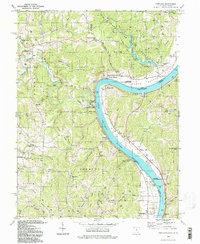
1994 Map of Portland
USGS Topo · Published 1998About this map
Shade River State Forest and the Forked Run State Park dominate the northern terrain of this riverfront landscape, where the Ohio River carves a deep bend through the borderlands of Ohio and West Virginia. Settlement patterns are tied closely to the river's path and the ridgelines of Spicer Ridge and Milhoan Ridge. Small communities and river landings like Long Bottom, Murraysville, and Portland serve as focal points for local history, supported by numerous country cemeteries including Sand Hill Cem and Middleswart Cem. The map reveals a rural economy shaped by topographic necessity, with gas wells scattered across the hills and significant natural spaces like the Ohio River State Wildlife Access area. Notable landmarks such as the Buffington Island State Memorial near the southern boundary underscore the region's historical depth during the late twentieth century.
Find a feature on this map
89 named features on this map. Tap any name to fly to it.
Don’t see what you’re looking for? This feature index may not catch every label — zoom into the map to look around manually.
Map Details
Editions of this 1994 Portland Map
This is the sole edition of this map. No revisions or reprints were ever made.
Other maps of this area

1906 · Belleville
USGS Topo · 1:62,500

1907 · Keno
USGS Topo · 1:62,500

1907 · Ripley
USGS Topo · 1:62,500

1908 · Ravenswood
USGS Topo · 1:62,500

1924 · Belleville
USGS Topo · 1:62,500

1926 · Ravenswood
USGS Topo · 1:62,500

1926 · Belleville
USGS Topo · 1:62,500

1926 · Ripley
USGS Topo · 1:62,500

1928 · Ravenswood
USGS Topo · 1:62,500

1928 · Ripley
USGS Topo · 1:62,500