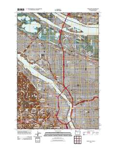
2011 Map of Portland
USGS Topo · Published 2011About this map
Willamette River and Columbia River define the industrial and residential core of this region, where major bridges like the Fremont Bridge and Marquam Bridge connect established neighborhoods. The landscape is a dense network of historic districts including Irvington, Laurelhurst, and Kings Heights, punctuated by large-scale logistics hubs such as Albina Yard and the shipping berths around Swan Island. Higher ground to the west is occupied by Willamette Heights and the Washington Park Zoo Railway Post Office, while the historic Lone Fir Cemetery and Ladd Circle remain prominent landmarks in East Portland. Educational and civic anchors such as Portland State University and the Pittock Block reflect the city's growth into a major Pacific Northwest center. Across the Interstate Bridge, the southern edge of Vancouver is visible, featuring Pearson Airpark and the Port of Vancouver Terminal along the northern banks.
Find a feature on this map
92 named features on this map. Tap any name to fly to it.
Don’t see what you’re looking for? This feature index may not catch every label — zoom into the map to look around manually.
Map Details
Editions of this 2011 Portland Map
This is the sole edition of this map. No revisions or reprints were ever made.
Other maps of this area

1897 · Portland
USGS Topo · 1:62,500

1905 · Portland
USGS Topo · 1:62,500

1914 · Oregon City
USGS Topo · 1:62,500

1915 · Hillsboro
USGS Topo · 1:62,500

1916 · Tualatin
USGS Topo · 1:62,500

1918 · Hillsboro
USGS Topo · 1:62,500

1939 · Oregon City
USGS Topo · 1:62,500

1939 · Tualatin
USGS Topo · 1:62,500

1940 · Tualatin
USGS Topo · 1:62,500

1940 · Hillsboro
USGS Topo · 1:62,500