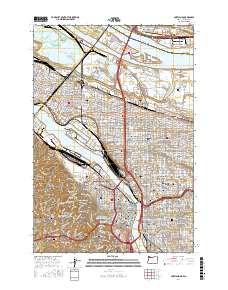
2017 Map of Portland
USGS Topo · Published 2017About this map
The Willamette River and Columbia River converge in this detailed mapping of the Oregon-Washington border, anchoring a landscape defined by industrial waterways and established urban neighborhoods. The map highlights the historic north-bank presence of Fort Vancouver National Historic Site and the adjacent Pearson Field, while the Portland side reveals the dense residential patterns of Albina, Irvington, and Alameda. Geologists and local historians can trace the transition from the low-lying Mocks Bottom and Columbia Slough to the prominent heights of Marquam Hill and the Tualatin Mountains. Notable for researchers are the numerous burial grounds, including the Historic Columbian Cem and Lone Fir Cem, alongside academic landmarks like the University Park campus and Portland Community Coll Cascade Campus.
Find a feature on this map
271 named features on this map. Tap any name to fly to it.
Don’t see what you’re looking for? This feature index may not catch every label — zoom into the map to look around manually.
Map Details
Editions of this 2017 Portland Map
This is the sole edition of this map. No revisions or reprints were ever made.
Other maps of this area

1897 · Portland
USGS Topo · 1:62,500

1905 · Portland
USGS Topo · 1:62,500

1914 · Oregon City
USGS Topo · 1:62,500

1915 · Hillsboro
USGS Topo · 1:62,500

1916 · Tualatin
USGS Topo · 1:62,500

1918 · Hillsboro
USGS Topo · 1:62,500

1939 · Oregon City
USGS Topo · 1:62,500

1939 · Tualatin
USGS Topo · 1:62,500

1940 · Tualatin
USGS Topo · 1:62,500

1940 · Hillsboro
USGS Topo · 1:62,500