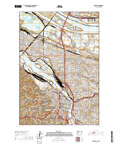
2020 Map of Portland
USGS Topo · Published 2020About this map
Willamette River and Columbia River shipping lanes dominate this 2020 layout, showing the dense urban core of Portland and its connection to Vancouver across the Interstate Bridge. The map reveals the intricate network of historic neighborhoods such as Saint Johns, Albina, and Irvington, alongside the industrial importance of the Swan Island Basin. Moving south from North Portland, the terrain rises into the hills of Portland Heights and Marquam Hill, where Portland State University and the Multnomah County Justice Center anchor the city center. This survey provides exceptional detail for genealogists and local historians, capturing established landmarks like the Lone Fir Cem and the Fort Vancouver National Historic Site, documenting the modern footprint of these storied Pacific Northwest communities.
Find a feature on this map
78 named features on this map. Tap any name to fly to it.
Don’t see what you’re looking for? This feature index may not catch every label — zoom into the map to look around manually.
Map Details
Editions of this 2020 Portland Map
This is the sole edition of this map. No revisions or reprints were ever made.
Other maps of this area

1897 · Portland
USGS Topo · 1:62,500

1905 · Portland
USGS Topo · 1:62,500

1914 · Oregon City
USGS Topo · 1:62,500

1915 · Hillsboro
USGS Topo · 1:62,500

1916 · Tualatin
USGS Topo · 1:62,500

1918 · Hillsboro
USGS Topo · 1:62,500

1939 · Oregon City
USGS Topo · 1:62,500

1939 · Tualatin
USGS Topo · 1:62,500

1940 · Tualatin
USGS Topo · 1:62,500

1940 · Hillsboro
USGS Topo · 1:62,500