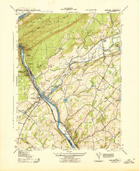
1943 Map of Portland
USGS Topo · Published 1943About this map
The Delaware Water Gap serves as the dramatic focal point of this 1942 Army Map Service survey, where the Delaware River cuts through the Kittatinny Mountains. This mid-century landscape is defined by its complex transportation network, with the New York Susquehanna and Western and Delaware Lackawanna and Western railroads converging near settlements like Columbia and Hainesburg. The map captures a period when river crossings remained vital, evidenced by the Myers Ferry operating near the village of Delaware. Local community life is well-documented through numerous rural landmarks, including the St James Church, Fairview Cemetery, and specialized sites like Camp Weygata (B S of A) and the Lake Susquehanna Airport (Abandoned). The terrain transitions from the steep ridges of Mount Tammany and Indian Head to the fertile valleys along the Paulins Kill, showing a region balanced between industrial rail transit and established valley farming.
Find a feature on this map
57 named features on this map. Tap any name to fly to it.
Don’t see what you’re looking for? This feature index may not catch every label — zoom into the map to look around manually.
Map Details
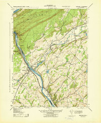
Editions of this 1943 Portland Map
2 editions found
Other maps of this area

1888 · Hackettstown
USGS Topo · 1:62,500

1891 · Wallpack
USGS Topo · 1:62,500

1891 · Delaware Water Gap
USGS Topo · 1:62,500

1893 · Delaware Water Gap
USGS Topo · 1:62,500

1893 · Wallpack
USGS Topo · 1:62,500

1894 · Hackettstown
USGS Topo · 1:62,500

1898 · Hackettstown
USGS Topo · 1:62,500

1900 · Raritan
USGS Topo · 1:125,000

1905 · Raritan
USGS Topo · 1:125,000

1905 · Hackettstown
USGS Topo · 1:62,500