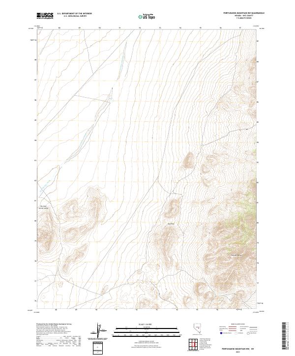
2021 Map of Portuguese Mountain NW
USGS Topo · Published 2021About this map
Sand Springs Wash carves a distinct path through this high-desert landscape in central Nevada, marking the transition from the broad expanse of Big Sand Springs Valley into the more complex topography of the east. The terrain is defined by the sharp rise of the Red Hills and the northern reaches of the Pancake Range, where the elevation lines tighten to reveal the steep ridges and drainage patterns typical of the Great Basin region. This topographic study captures a largely unpopulated stretch of Nye County, emphasizing the natural hydrology and land divisions of the Public Land Survey System. The scarcity of human development highlights the isolation of this sector, where the primary features are the geological formations and the seasonal watercourses that have shaped them over millennia.
Find a feature on this map
10 named features on this map. Tap any name to fly to it.
Don’t see what you’re looking for? This feature index may not catch every label — zoom into the map to look around manually.
Map Details
Editions of this 2021 Portuguese Mountain NW Map
This is the sole edition of this map. No revisions or reprints were ever made.
Other maps of this area

1956 · Lund
USGS Topo · 1:250,000

1956 · Tonopah
USGS Topo · 1:250,000

1959 · Tonopah
USGS Topo · 1:250,000

1960 · Lund
USGS Topo · 1:250,000

1962 · Tonopah
USGS Topo · 1:250,000

1967 · Moores Station
USGS Topo · 1:62,500

1967 · Moores Station SE
USGS Topo · 1:24,000

1967 · Chaos Creek
USGS Topo · 1:24,000

1968 · Portuguese Mtn
USGS Topo · 1:62,500
1968 · Brown Summit SW
USGS Topo · 1:24,000