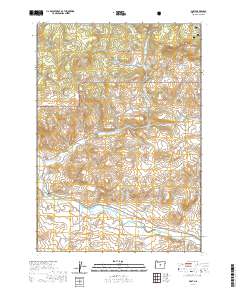
2020 Map of Post
USGS Topo · Published 2020About this map
The high desert landscape of central Oregon converges at Post, a settlement situated near the geographical center of the state. This 2020 survey illustrates a region defined by its hydrology and upland relief, where the Crooked River snakes across the southern portion of the quadrangle, joined by tributaries such as Newsome Cr and Pine Stub Cr. North of the river, the terrain ascends into the volcanic and sedimentary heights of the Ochoco National Forest, characterized by prominent landmarks like Pollard Butte and Joe Butte.
Find a feature on this map
29 named features on this map. Tap any name to fly to it.
Don’t see what you’re looking for? This feature index may not catch every label — zoom into the map to look around manually.
Map Details
Editions of this 2020 Post Map
This is the sole edition of this map. No revisions or reprints were ever made.
Other maps of this area

1946 · Eagle Rock
USGS Topo · 1:62,500

1948 · Eagle Rock
USGS Topo · 1:62,500

1948 · Ochoco Reservoir
USGS Topo · 1:62,500

1950 · Ochoco Reservoir
USGS Topo · 1:62,500

1951 · Post
USGS Topo · 1:62,500

1951 · Lookout Mtn
USGS Topo · 1:62,500

1955 · Bend
USGS Topo · 1:250,000

1957 · Bend
USGS Topo · 1:250,000

1958 · Bend
USGS Topo · 1:250,000

1981 · Prineville
USGS Topo · 1:100,000