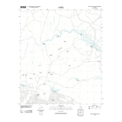
2010 Map of Post Oak Mountain
USGS Topo · Published 2010About this map
Hood Army Air Field and the northern residential expansion of Killeen dominate the southern portion of this landscape, marking the intersection of military infrastructure and urban growth in Central Texas. The terrain north of the airfield transitions into a series of prominent limestone ridges and peaks, including Post Oak Mountain, Sugar Loaf Mountain, and Castle Mountain. These elevations are separated by several named gaps and hollows, such as Black Gap and Egypt Hollow, which define the local drainage patterns toward the winding Cowhouse Creek and North Nolan Creek.
Find a feature on this map
51 named features on this map. Tap any name to fly to it.
Don’t see what you’re looking for? This feature index may not catch every label — zoom into the map to look around manually.
Map Details
Editions of this 2010 Post Oak Mountain Map
This is the sole edition of this map. No revisions or reprints were ever made.
Other maps of this area

1894 · Gatesville
USGS Topo · 1:125,000

1924 · Gatesville 4-d
USGS Topo · 1:48,000

1924 · Gatesville 4-a
USGS Topo · 1:48,000

1930 · Killeen
USGS Topo · 1:62,500

1947 · Fort Hood
USGS Topo · 1:62,500

1947 · Bland
USGS Topo · 1:24,000

1947 · Fort Hood
USGS Topo · 1:24,000

1947 · Purmela
USGS Topo · 1:62,500

1947 · Post Oak Mountain
USGS Topo · 1:24,000

1947 · Killeen
USGS Topo · 1:62,500
Featured Places
- Killeen, TX
- Wainwright Heights North, TX
- Patton Park, TX
- Wainwright Heights, TX
- Wainwright Heights EXP, TX