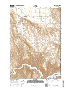
2017 Map of Posy Valley
USGS Topo · Published 2017About this map
Halfway and the surrounding agricultural basin of Pine Valley define the northern landscape of this Baker County map, where water management is central to the local economy. A complex network of irrigation and water sources, including the McMullen Ditch, Laird Reservoir, and several spring-fed sites like Tarter Spring, supports the high-desert terrain. Transportation in the valley is anchored by HWY 12 and the Pine Valley Airport, while specialized access roads like Sawmill Cutoff Ln and Pine Town Ln serve the smaller settlements of Pine and Posy Valley. To the south, the terrain descends sharply through a series of dramatic drainages, such as Little Timber Canyon and Ruth Gulch, toward the Brownlee Reservoir on the Snake River. This southern reach marks the state boundary between Oregon and Idaho, with the former settlement site of Robinette situated near the county line between Baker and Washington Counties.
Find a feature on this map
44 named features on this map. Tap any name to fly to it.
Don’t see what you’re looking for? This feature index may not catch every label — zoom into the map to look around manually.
Map Details
Editions of this 2017 Posy Valley Map
This is the sole edition of this map. No revisions or reprints were ever made.
Other maps of this area

1915 · Pine
USGS Topo · 1:125,000

1955 · Baker
USGS Topo · 1:250,000

1957 · Halfway
USGS Topo · 1:62,500

1957 · Copperfield
USGS Topo · 1:62,500

1957 · Sturgill Peak
USGS Topo · 1:62,500

1957 · Mineral
USGS Topo · 1:62,500

1959 · Baker
USGS Topo · 1:250,000

1980 · McCall
USGS Topo · 1:100,000

1981 · Baker
USGS Topo · 1:100,000
1987 · Mc Lain Gulch
USGS Topo · 1:24,000