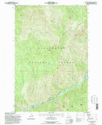
1994 Map of Pot Mountain
USGS Topo · Published 1997About this map
Pot Mountain Ridge dominates this northern Idaho landscape, overlooking a series of high-elevation basins and glacial features. The map illustrates a transitional period in the management of the Clearwater National Forest, where high points such as Buckingham Point, Green Point, and Bugle Point define the local topography. Water is a central element, from the alpine clusters of Pot Lake and Mush Lake in the north to the powerful North Fork Clearwater River flowing along the southern boundary.
Find a feature on this map
30 named features on this map. Tap any name to fly to it.
Don’t see what you’re looking for? This feature index may not catch every label — zoom into the map to look around manually.
Map Details
Editions of this 1994 Pot Mountain Map
This is the sole edition of this map. No revisions or reprints were ever made.
Other maps of this area

1911 · Lolo
USGS Topo · 1:250,000

1913 · Lolo
USGS Topo · 1:250,000

1923 · Washington Creek
USGS Topo · 1:125,000

1956 · Hamilton
USGS Topo · 1:250,000

1959 · Hamilton
USGS Topo · 1:250,000

1960 · Hamilton
USGS Topo · 1:250,000

1963 · Sheep Mtn
USGS Topo · 1:24,000
1963 · The Nub
USGS Topo · 1:24,000

1963 · Clarke Mtn
USGS Topo · 1:24,000
1963 · Elizabeth Lake
USGS Topo · 1:24,000