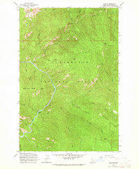
1963 Map of The Nub
USGS Topo · Published 1964About this map
The North Fork Clearwater River winds through the heart of the Clearwater National Forest in this early 1960s topographic study. This landscape is defined by its deep drainages and high lookout points, such as the Wallow Mtn Lookout and the prominent peak known as The Nub, which overlooks the small Nub Lakes. Evidence of high-altitude habitation and resource management appears at the Collins Creek Cabin and the riverside landing at Moscow Bar. The map reveals a complex network of named ridges and mountain ranges, including Indian Henry Ridge and the Sheep Mtn Range, which served as critical landmarks for foresters and early backcountry travelers. Numerous tributaries like Skull Creek and Quartz Creek feed the main river, illustrating the intricate drainage patterns of the Clearwater drainage before significant modern development altered the wilderness character.
Find a feature on this map
35 named features on this map. Tap any name to fly to it.
Don’t see what you’re looking for? This feature index may not catch every label — zoom into the map to look around manually.
Map Details
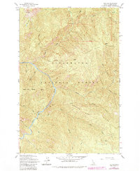
Editions of this 1963 The Nub Map
2 editions found
Other maps of this area

1911 · Lolo
USGS Topo · 1:250,000

1913 · Lolo
USGS Topo · 1:250,000

1923 · Washington Creek
USGS Topo · 1:125,000

1956 · Hamilton
USGS Topo · 1:250,000

1959 · Hamilton
USGS Topo · 1:250,000

1960 · Hamilton
USGS Topo · 1:250,000
1963 · Mallard Peak
USGS Topo · 1:24,000

1963 · Sheep Mtn
USGS Topo · 1:24,000
1963 · Pole Mtn
USGS Topo · 1:24,000

1963 · Clarke Mtn
USGS Topo · 1:24,000