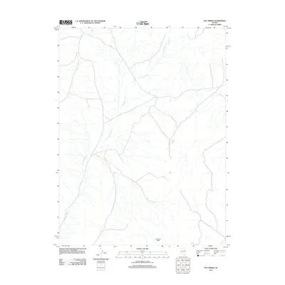
2012 Map of Pot Spring
USGS Topo · Published 2012About this map
Pot Spring and White Rock Spring emerge as critical water sources in this high-desert region of Elko County, defined by the extensive drainage network of Long Valley Wash. The landscape is characterized by its dramatic vertical relief, culminating at Hamilton Butte in the southern portion of the quadrangle. This 2012 survey documents a largely unpopulated area where topography and hydrology dictate the routes of sparse local roads and 4WD tracks. The intricate branching of the wash system suggests a terrain shaped by seasonal water flow, where these named springs likely served as vital landmarks for early ranchers and travelers navigating the basin and range province.
Find a feature on this map
4 named features on this map. Tap any name to fly to it.
Don’t see what you’re looking for? This feature index may not catch every label — zoom into the map to look around manually.
Map Details
Editions of this 2012 Pot Spring Map
This is the sole edition of this map. No revisions or reprints were ever made.
Other maps of this area

1955 · Elko
USGS Topo · 1:250,000

1956 · Ely
USGS Topo · 1:250,000

1958 · Elko
USGS Topo · 1:250,000

1959 · Ely
USGS Topo · 1:250,000

1962 · Elko
USGS Topo · 1:250,000

1963 · Ely
USGS Topo · 1:250,000

1965 · Elko
USGS Topo · 1:250,000
1968 · Ruby Lake SE
USGS Topo · 1:24,000

1968 · Ruby Lake NE
USGS Topo · 1:24,000

1982 · Ninemile Well
USGS Topo · 1:24,000