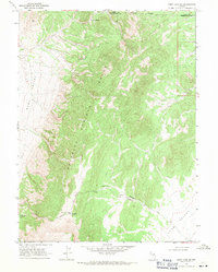
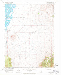
1968 Map of Ruby Lake SE
USGS Topo · Published 1971About this map
The high desert landscape of the Maverick Springs Range dominates this 1968 survey of eastern Nevada. This terrain is characterized by sparse water sources and dramatic elevation changes, with Willow Spring and Salas Spring serving as vital landmarks in an otherwise arid environment. The map shows the transition between the upland peaks and the broad basins of Ruby Valley and Long Valley. Cattle ranching and mineral exploration are the primary human activities implied by the network of unimproved roads and jeep trails that wind through the canyons. This edition captures the area before modern land-use changes, preserving the remote character of the White Pine County interior during the mid-20th century.
Find a feature on this map
2 named features on this map. Tap any name to fly to it.
Don’t see what you’re looking for? This feature index may not catch every label — zoom into the map to look around manually.
Map Details
Editions of this 1968 Ruby Lake SE Map
2 editions found
Other maps of this area

1955 · Elko
USGS Topo · 1:250,000

1956 · Ely
USGS Topo · 1:250,000

1958 · Elko
USGS Topo · 1:250,000

1959 · Ely
USGS Topo · 1:250,000

1962 · Elko
USGS Topo · 1:250,000

1963 · Ely
USGS Topo · 1:250,000

1965 · Elko
USGS Topo · 1:250,000
1968 · Ruby Lake NW
USGS Topo · 1:24,000
1968 · Ruby Lake NE
USGS Topo · 1:24,000
1969 · Station Butte
USGS Topo · 1:24,000