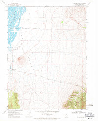
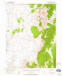
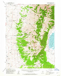
1969 Map of Station Butte
USGS Topo · Published 1971About this map
Ruby Valley dominates this high-desert basin, where the Ruby Lake National Wildlife Refuge protects the critical marshlands and open waters of Ruby Lake. The map details the hydrology of this arid region, from the South Sump to individual water sources like Station Spring and Woodwards Creek.
Find a feature on this map
12 named features on this map. Tap any name to fly to it.
Don’t see what you’re looking for? This feature index may not catch every label — zoom into the map to look around manually.
Map Details
Editions of this 1969 Station Butte Map
This is the sole edition of this map. No revisions or reprints were ever made.
Other maps of this area

1934 · Jiggs
USGS Topo · 1:125,000

1937 · Jiggs
USGS Topo · 1:125,000

1955 · Elko
USGS Topo · 1:250,000

1956 · Ely
USGS Topo · 1:250,000
1957 · Cold Creek Ranch
USGS Topo · 1:62,500

1958 · Elko
USGS Topo · 1:250,000

1959 · Ely
USGS Topo · 1:250,000
1959 · Sherman Mtn
USGS Topo · 1:62,500

1962 · Elko
USGS Topo · 1:250,000

1963 · Ely
USGS Topo · 1:250,000