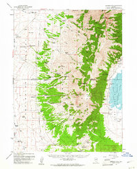
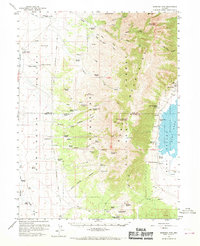
1959 Map of Sherman Mtn
USGS Topo · Published 1961About this map
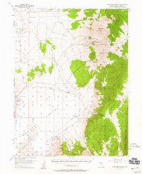
Huntington Valley and the high elevations of the Ruby Mountains dominate this late-1950s survey of the Nevada interior. The landscape is defined by the transition from the arid valley floor, drained by Huntington Creek, to the steep canyons of the Humboldt National Forest. Human presence is largely tied to ranching and early transit, evidenced by numerous family operations such as Sadler Ranch, Juaristi Ranch, and Goyeneche Ranch. The presence of the Elko-Hamilton Stage Lines traces a path through the valley, marking a historic transportation corridor. To the east, the map captures the western edge of the Ruby Lake National Wildlife Refuge, where the terrain drops away into Ruby Valley. High points like Sherman Mountain and Pearl Peak overlook a network of seasonal springs and remote structures like Johnson Cabin.
Find a feature on this map
67 named features on this map. Tap any name to fly to it.
Don’t see what you’re looking for? This feature index may not catch every label — zoom into the map to look around manually.
Map Details
Editions of this 1959 Sherman Mtn Map
2 editions found
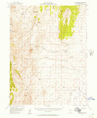
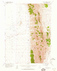
Other maps of this area

1934 · Jiggs
USGS Topo · 1:125,000

1937 · Jiggs
USGS Topo · 1:125,000

1955 · Elko
USGS Topo · 1:250,000
1956 · Robinson Mtn
USGS Topo · 1:62,500

1956 · Ely
USGS Topo · 1:250,000
1957 · Diamond Springs
USGS Topo · 1:62,500
1957 · Cold Creek Ranch
USGS Topo · 1:62,500

1958 · Elko
USGS Topo · 1:250,000

1959 · Ely
USGS Topo · 1:250,000
1959 · Jiggs
USGS Topo · 1:62,500