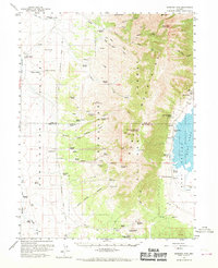
1959 Map of Sherman Mtn
USGS Topo · Published 1970About this map
Elko-Hamilton Stage Lines trace a historical transportation corridor through this high-desert basin, marking a time when overland travel relied on established routes through Huntington Valley and across the Sherman Mountains. The map reveals a landscape defined by isolated homesteads and livestock operations such as Goyeneche Ranch, Jaimerena Ranch, and Sadler Ranch, many of which are situated near vital water sources like Belmont Springs and Washout Spring.
Find a feature on this map
76 named features on this map. Tap any name to fly to it.
Don’t see what you’re looking for? This feature index may not catch every label — zoom into the map to look around manually.
Map Details
Editions of this 1959 Sherman Mtn Map
2 editions found

Other maps of this area

1934 · Jiggs
USGS Topo · 1:125,000

1937 · Jiggs
USGS Topo · 1:125,000

1955 · Elko
USGS Topo · 1:250,000

1956 · Robinson Mtn
USGS Topo · 1:62,500

1956 · Ely
USGS Topo · 1:250,000

1957 · Diamond Springs
USGS Topo · 1:62,500

1957 · Cold Creek Ranch
USGS Topo · 1:62,500

1958 · Elko
USGS Topo · 1:250,000

1959 · Ely
USGS Topo · 1:250,000

1959 · Jiggs
USGS Topo · 1:62,500