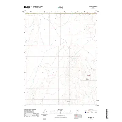
2018 Map of Pot Spring
USGS Topo · Published 2018About this map
Long Valley dominates the central floor of this high-altitude basin landscape, which straddles the boundary between Elko and White Pine counties. The terrain is characterized by the ephemeral drainage of Long Valley Wash, which cuts north-to-south through the valley floor. To the east, the topography rises sharply into the Butte Mountains, while Hamilton Butte serves as a prominent landmark in the south. The presence of Pot Spring and White Rock Spring along the mountain flanks suggests the vital role of these isolated water sources in an otherwise arid region of Nevada. The map details the complex Public Land Survey System grid, including townships t26n r60e and t25n r61e, providing a precise look at the land division and remote road tracks used for access during the early twenty-first century.
Find a feature on this map
11 named features on this map. Tap any name to fly to it.
Don’t see what you’re looking for? This feature index may not catch every label — zoom into the map to look around manually.
Map Details
Editions of this 2018 Pot Spring Map
This is the sole edition of this map. No revisions or reprints were ever made.
Other maps of this area

1955 · Elko
USGS Topo · 1:250,000

1956 · Ely
USGS Topo · 1:250,000

1958 · Elko
USGS Topo · 1:250,000

1959 · Ely
USGS Topo · 1:250,000

1962 · Elko
USGS Topo · 1:250,000

1963 · Ely
USGS Topo · 1:250,000

1965 · Elko
USGS Topo · 1:250,000
1968 · Ruby Lake SE
USGS Topo · 1:24,000

1968 · Ruby Lake NE
USGS Topo · 1:24,000

1982 · Ninemile Well
USGS Topo · 1:24,000