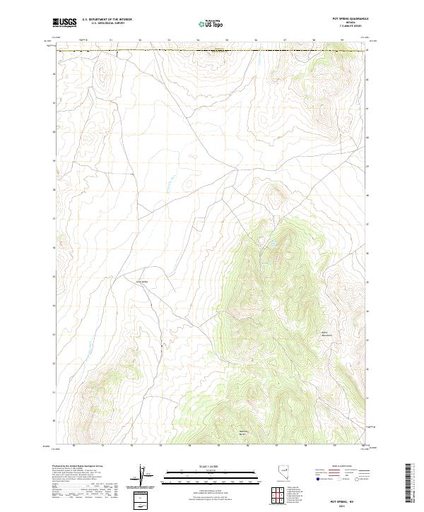
2021 Map of Pot Spring
USGS Topo · Published 2021About this map
Long Valley Wash carves through this high-elevation basin in eastern Nevada, marking a landscape defined by seasonal water flow and stark relief. The boundary between Elko and White Pine counties cuts across the northern edge of this territory, where the terrain rises toward the southern reaches of the Butte Mountains. Within this arid expanse, the presence of Pot Spring and White Rock Spring suggests critical watering points that have historically dictated movement and land use in an area otherwise dominated by the broad, open reach of Long Valley. The map details the transition from the level floor of the wash to the steep, rising contours of Hamilton Butte, offering a clear view of the topographic isolation and hydraulic features that characterize this portion of the Great Basin.
Find a feature on this map
11 named features on this map. Tap any name to fly to it.
Don’t see what you’re looking for? This feature index may not catch every label — zoom into the map to look around manually.
Map Details
Editions of this 2021 Pot Spring Map
This is the sole edition of this map. No revisions or reprints were ever made.
Other maps of this area

1955 · Elko
USGS Topo · 1:250,000

1956 · Ely
USGS Topo · 1:250,000

1958 · Elko
USGS Topo · 1:250,000

1959 · Ely
USGS Topo · 1:250,000

1962 · Elko
USGS Topo · 1:250,000

1963 · Ely
USGS Topo · 1:250,000

1965 · Elko
USGS Topo · 1:250,000
1968 · Ruby Lake SE
USGS Topo · 1:24,000

1968 · Ruby Lake NE
USGS Topo · 1:24,000

1982 · Ninemile Well
USGS Topo · 1:24,000