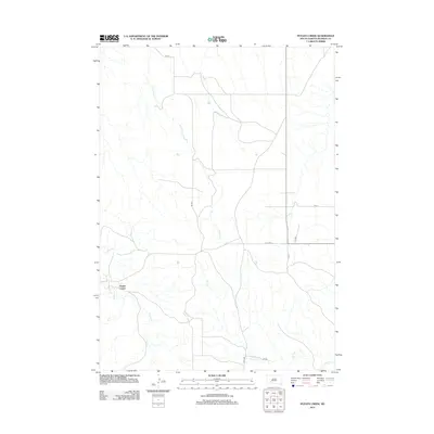
2012 Map of Potato Creek
USGS Topo · Published 2012About this map
Potato Creek stands as the primary settlement in this corner of South Dakota, situated near the confluence of several prominent drainage systems. The landscape is defined by the winding paths of Lost Dog Cr and Turtle Cr, which dictate the local topography and the alignment of rural transit routes. Bureau of Indian Affairs infrastructure provides the essential framework for movement across this terrain, most notably via Bia Rd and Bia Hwy 2. These routes connect the scattered homesteads and natural landmarks, such as Bull Cr, to the larger regional network. The distribution of these waterways and roads reflects a settlement pattern tied closely to the natural hydrology of the plains, where access to water and established transit corridors remains vital for the community.
Find a feature on this map
12 named features on this map. Tap any name to fly to it.
Don’t see what you’re looking for? This feature index may not catch every label — zoom into the map to look around manually.
Map Details
Editions of this 2012 Potato Creek Map
This is the sole edition of this map. No revisions or reprints were ever made.
Other maps of this area

1950 · Interior
USGS Topo · 1:24,000

1950 · Interior SE
USGS Topo · 1:24,000

1950 · Potato Creek
USGS Topo · 1:24,000

1951 · School Section Butte
USGS Topo · 1:24,000

1952 · Conata NE
USGS Topo · 1:24,000

1952 · Conata SE
USGS Topo · 1:24,000

1955 · Hot Springs
USGS Topo · 1:250,000

1955 · Martin
USGS Topo · 1:250,000

1958 · Martin
USGS Topo · 1:250,000

1980 · Kadoka
USGS Topo · 1:100,000