1950 Map of Potato Creek
USGS Topo · Published 1979About this map
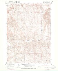
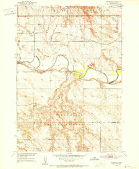
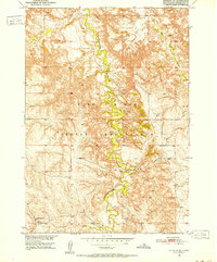
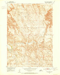
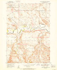
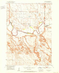
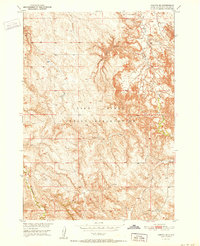
Pine Ridge Indian Reservation lands define this territory, where the settlement of Potato Creek sits along the banks of its namesake waterway. This mid-century survey, updated in the late 1970s, captures a landscape of prairie drainage and intermittent streams including Lost Dog Creek and Turtle Creek. The placement of a Cem near the primary settlement and scattered Windmill sites across the terrain points to the ranching economy and established community life in this portion of Washabaugh County. The map provides a detailed view of the section lines and topography that governed land use during the development of the Missouri River Basin project, showing a network of unimproved roads and light-duty trails that linked these remote outposts.
Find a feature on this map
10 named features on this map. Tap any name to fly to it.
Don’t see what you’re looking for? This feature index may not catch every label — zoom into the map to look around manually.
Map Details
Editions of this 1950 Potato Creek Map
2 editions found
Other maps of this area
1950 · Interior
USGS Topo · 1:24,000
1950 · Interior SE
USGS Topo · 1:24,000
1950 · Potato Creek
USGS Topo · 1:24,000
1951 · School Section Butte
USGS Topo · 1:24,000
1952 · Conata NE
USGS Topo · 1:24,000
1952 · Conata SE
USGS Topo · 1:24,000

1955 · Hot Springs
USGS Topo · 1:250,000

1955 · Martin
USGS Topo · 1:250,000

1958 · Martin
USGS Topo · 1:250,000

1980 · Kadoka
USGS Topo · 1:100,000