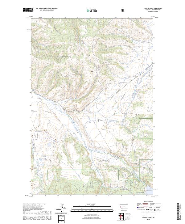
2024 Map of Potato Lakes
USGS Topo · Published 2024About this map
The John Long Mountains and Sapphire Mountains dominate this high-country landscape in Granite County, where the Deerlodge National Forest encompasses vast stretches of timbered terrain. Water management is central to the area's layout, evidenced by the Flint Creek Canal and the Carey Lateral diverting flows across the Philipsburg Valley. Numerous small water bodies, notably the Potato Lakes, are scattered throughout the western sections, while the East Fork Reservoir sits at the base of the Anaconda Range in the southeast corner.
Find a feature on this map
50 named features on this map. Tap any name to fly to it.
Don’t see what you’re looking for? This feature index may not catch every label — zoom into the map to look around manually.
Map Details
Editions of this 2024 Potato Lakes Map
This is the sole edition of this map. No revisions or reprints were ever made.
Other maps of this area

1908 · Philipsburg
USGS Topo · 1:125,000

1909 · Sapphire
USGS Topo · 1:125,000

1947 · Butte
USGS Topo · 1:250,000

1958 · Butte
USGS Topo · 1:250,000

1960 · Butte
USGS Topo · 1:250,000

1962 · Butte
USGS Topo · 1:250,000

1971 · Georgetown Lake
USGS Topo · 1:24,000

1971 · Antelope Creek
USGS Topo · 1:24,000

1971 · Potato Lakes
USGS Topo · 1:24,000
1971 · Philipsburg
USGS Topo · 1:24,000