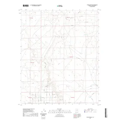
2021 Map of Potato Wash NE
USGS Topo · Published 2021About this map
Squaw Wash carves a central path through this section of Navajo County, defining a landscape marked by intermittent water sources and a network of rural access roads. The geographic distribution of livestock tanks, including Ward Tank, Chuck Box Tank, and Big Round Tank, indicates the area's continued reliance on managed water for ranching. In the southern reaches, a more structured residential or recreational layout appears near Buffington Hill Rd and Squaw Tank Vista Dr, where smaller tracts are bisected by named lanes like Vaquero's End and Gidcomb Ln. This 2021 survey illustrates the modern intersection of traditional high-desert ranching infrastructure and contemporary rural development, seen in the transition from open range to the clusters of named roads near Twin Tank and Duck Lake Tank.
Find a feature on this map
48 named features on this map. Tap any name to fly to it.
Don’t see what you’re looking for? This feature index may not catch every label — zoom into the map to look around manually.
Map Details
Editions of this 2021 Potato Wash NE Map
This is the sole edition of this map. No revisions or reprints were ever made.
Other maps of this area

1886 · Holbrook
USGS Topo · 1:250,000

1893 · Holbrook
USGS Topo · 1:250,000

1954 · Holbrook
USGS Topo · 1:250,000

1955 · Joseph City
USGS Topo · 1:62,500

1957 · Holbrook
USGS Topo · 1:250,000

1958 · Holbrook
USGS Topo · 1:250,000

1960 · Holbrook
USGS Topo · 1:250,000

1970 · Red Knoll
USGS Topo · 1:24,000
1970 · Relic Point
USGS Topo · 1:24,000
1970 · McCauley Sinks
USGS Topo · 1:24,000