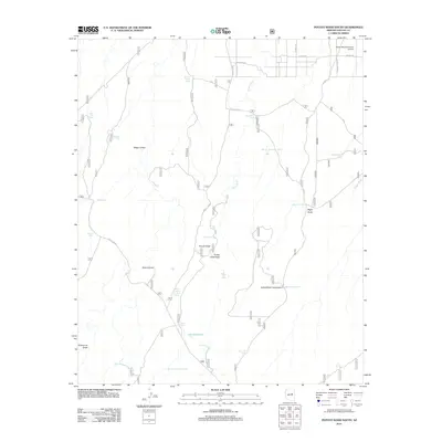
2011 Map of Potato Wash South
USGS Topo · Published 2011About this map
Wisky Ranch/Chevlon Airport sits at the northern edge of this high-plateau landscape in Navajo County, where a sparse network of forest roads and aviation infrastructure meets a rugged drainage system. The terrain is defined by complex erosional features including Daze Canyon, Potato Field Draw, and Grapevine Draw, which channel seasonal water toward the primary artery of Potato Wash.
Find a feature on this map
38 named features on this map. Tap any name to fly to it.
Don’t see what you’re looking for? This feature index may not catch every label — zoom into the map to look around manually.
Map Details
Editions of this 2011 Potato Wash South Map
This is the sole edition of this map. No revisions or reprints were ever made.
Other maps of this area

1886 · Holbrook
USGS Topo · 1:250,000

1893 · Holbrook
USGS Topo · 1:250,000

1954 · Holbrook
USGS Topo · 1:250,000

1957 · Holbrook
USGS Topo · 1:250,000

1958 · Holbrook
USGS Topo · 1:250,000

1960 · Holbrook
USGS Topo · 1:250,000

1961 · Woods Canyon
USGS Topo · 1:62,500

1961 · Heber
USGS Topo · 1:62,500

1965 · Chevelon Crossing
USGS Topo · 1:24,000

1970 · Red Knoll
USGS Topo · 1:24,000