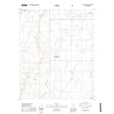
2021 Map of Potato Wash South
USGS Topo · Published 2021About this map
Sitgreaves National Forest and the vast Mogollon Plateau define this high-altitude landscape in Navajo County, where a network of dry washes and deep canyons carve through the terrain. The map details a sophisticated water management system critical for ranching and forest survival, featuring numerous named catchments such as Upper Purcell Tank, Bitumul Tank, and Section Twelve Tank. In the northeastern corner, the Wisky Ranch/Chevlon Airport and nearby residential streets like Chevlon Ave and Airplane LN indicate a pocket of mountain habitation. Historical movement across the rugged breaks is marked by Heber Mormon Crossing and several significant drainages, including Chevelon Canyon and Wildcat Canyon. The map reveals how modern accessibility via Chevelon Retreat meets the traditional ranching infrastructure that has long sustained this corner of the Arizona high country.
Find a feature on this map
44 named features on this map. Tap any name to fly to it.
Don’t see what you’re looking for? This feature index may not catch every label — zoom into the map to look around manually.
Map Details
Editions of this 2021 Potato Wash South Map
This is the sole edition of this map. No revisions or reprints were ever made.
Other maps of this area

1886 · Holbrook
USGS Topo · 1:250,000

1893 · Holbrook
USGS Topo · 1:250,000

1954 · Holbrook
USGS Topo · 1:250,000

1957 · Holbrook
USGS Topo · 1:250,000

1958 · Holbrook
USGS Topo · 1:250,000

1960 · Holbrook
USGS Topo · 1:250,000

1961 · Woods Canyon
USGS Topo · 1:62,500

1961 · Heber
USGS Topo · 1:62,500

1965 · Chevelon Crossing
USGS Topo · 1:24,000

1970 · Red Knoll
USGS Topo · 1:24,000