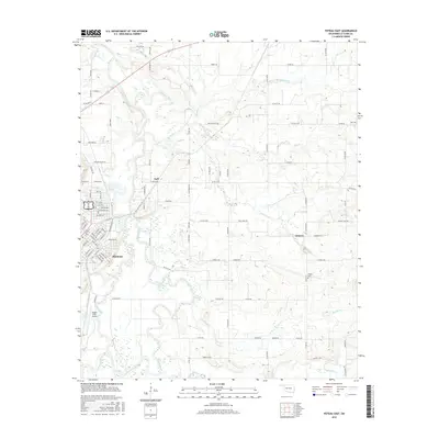
2016 Map of Poteau East
USGS Topo · Published 2016About this map
The city of Poteau anchors the southwestern portion of this landscape, where the Poteau River winds through a complex network of waterways including The Cutoff and the Lost Poteau River. The topography is defined by the transition from the river basin to elevations like Durant Hill, with several small settlements such as Gilmore and Neff connected by a grid of county roads. Aviation infrastructure is prominent at the Robert S Kerr Airport, situated near the oxbows of Terrell Lake. This map provides significant genealogical value through the documentation of the Vaughn Cem and Hall Cem, which sit alongside family-named routes like Towry Rd and Nail Creek Rd. The drainage patterns of Gap Cr and Sugarloaf Cr reflect the natural irrigation of this corner of LeFlore County.
Find a feature on this map
67 named features on this map. Tap any name to fly to it.
Don’t see what you’re looking for? This feature index may not catch every label — zoom into the map to look around manually.
Map Details
Editions of this 2016 Poteau East Map
This is the sole edition of this map. No revisions or reprints were ever made.
Other maps of this area

1887 · Poteau Mountain #2
USGS Topo · 1:62,500

1887 · Greenwood
USGS Topo · 1:62,500

1890 · Fort Smith
USGS Topo · 1:125,000

1890 · Poteau Mountain
USGS Topo · 1:125,000

1899 · Poteau Mountain
USGS Topo · 1:125,000

1900 · Sallisaw
USGS Topo · 1:125,000

1900 · Winding Stair
USGS Topo · 1:125,000

1909 · Winding Stair
USGS Topo · 1:125,000

1911 · Sallisaw
USGS Topo · 1:125,000

1943 · Fort Smith
USGS Topo · 1:125,000